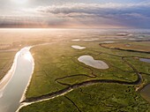
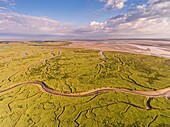
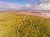
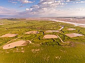
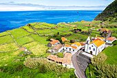
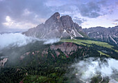
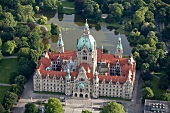
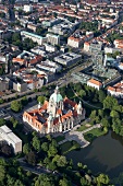
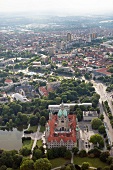
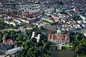
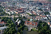
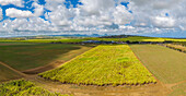
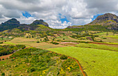
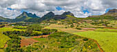
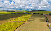
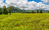
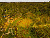
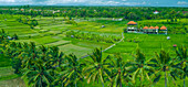
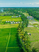
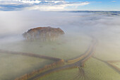
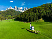
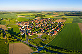
70330703 - Aerial view of meadows of the Innerste river, nature reserve, Lower Saxony, Germany70330450 - aerial view of meadows, farms and farmland, near Cuxhaven, Lower Saxony, Germany71192710 - aerial view on glowing green meadows in Franconia, Bavaria, Germany13707173 - Green forest and meadows surrounding the small Ranui church and Odle in spring, aerial view, Funes Valley, Dolomites, South Tyrol, Italy, Europe71359473 - Green meadows framed by snow capped mountains in spring, aerial view, Braulio Valley, Bormio, Valtellina, Lombardy, Italy71359463 - Cows in green meadows at feet of Cime di Terrarossa emerging from fog, aerial view, Seiser Alm, Dolomites, South Tyrol, Italy14259665 - France, Somme, Baie de Somme, Saint Valery sur Somme, Cape Hornu, the salted meadows invaded by the sea during high tides, the channels and the ponds of hunting huts are then clearly visible (aerial view)14259595 - France, Pas de Calais, Bay of Authie, Groffliers, flight over the Bay of Authie from the port of Madelon, the pools in the salted meadows are those of hunting huts (Aerial view)14333944 - France, Somme, Bay of Somme, Noyelles-sur-mer, the salted meadows of the Bay of the Somme in the early morning with the channels and ponds of hunting huts, a little mist (aerial view)14259663 - France, Somme, Baie de Somme, Saint Valery sur Somme, Cape Hornu, the salted meadows invaded by the sea during high tides, the channels and the ponds of hunting huts are then clearly visible (aerial view)14101922 - France, Manche, Ste Mere Eglise, cows and meadows near the Merderet river (aerial view)14259565 - France, Pas de Calais, Bay of Authie, Groffliers, flight over the Bay of Authie from the port of Madelon, the pools in the salted meadows are those of hunting huts (Aerial view)13937828 - France, Somme, Bay of Somme, Saint-Valery-sur-Somme, The salted meadows of the Bay of the Somme in the early morning at Cape Hornu (aerial view)\n13937510 - France, Somme, Bay of Somme, Saint-Valery-sur-Somme, The salted meadows of the Bay of the Somme in the early morning at Cape Hornu (aerial view)\n13937449 - France, Somme, Bay of Somme, Saint-Valery-sur-Somme, The salted meadows of the Bay of the Somme in the early morning at Cape Hornu (aerial view)\n13934176 - France, Somme, Bay of Somme, Noyelles-sur-mer, the salted meadows of the Bay of the Somme in the early morning with the channels and the pools of hunting huts, a little mist, and Saint-Valery-sur-Somme in the background (aerial view)\n13930780 - France, Vendee, Lairoux, cows and horses in yellow flowery meadows (aerial view)\n13930335 - France, Somme, Bay of Somme, Noyelles-sur-mer, the salted meadows of the Bay of the Somme in the early morning with the channels and the pools of hunting huts, and Saint-Valery-sur-Somme in the background (aerial view)\n13929565 - France, Somme, Somme Bay, Saint Valery sur Somme, high tides, the salted meadows around Saint Valery gradually invaded by the sea (aerial view)\n13979630 - France,Gironde,Bassin d'Arcachon,Arcachon,Aiguillon beach with Teste de Buch,salt meadows and Dune du Pilat (aerial view)13935863 - France, Vendee, Lairoux, cows and horses in yellow flowery meadows (aerial view)\n13932391 - France, Somme, Bay of Somme, Noyelles-sur-mer, the salted meadows of the Bay of the Somme in the early morning with the channels and ponds of hunting huts, a little mist (aerial view)\n13974762 - France,Pas de Calais,Bay of Authie,Groffliers,flight over the Bay of Authie from the port of Madelon,the pools in the salted meadows are those of hunting huts (Aerial view)13937173 - France, Somme, Somme Bay, Saint Valery sur Somme, high tides, the salted meadows around Saint Valery gradually invaded by the sea (aerial view)\n13935823 - France, Somme, Bay of Somme, Noyelles-sur-mer, the salted meadows of the Bay of the Somme in the early morning with the channels and ponds of hunting huts, a little mist (aerial view)\n13978461 - France,Somme,Baie de Somme,Saint Valery sur Somme,Cape Hornu,the salted meadows invaded by the sea during high tides,the channels and the ponds of hunting huts are then clearly visible (aerial view)13936467 - France, Somme, Baie de Somme, Le Hourdel, High tides in the Baie de Somme, The meadows around the Hourdel invaded by water, Le Hourdel and its port (Aerial view)\n13932261 - France, Somme, Somme Bay, Saint Valery sur Somme, Cape Hornu, the salted meadows and channels at dawn at low tide (aerial view)\n13973576 - France,Somme,Baie de Somme,Saint Valery sur Somme,Cape Hornu,the salted meadows invaded by the sea during high tides,the channels and the ponds of hunting huts are then clearly visible (aerial view)13937109 - France, Somme, Somme Bay, Saint Valery sur Somme, Cape Hornu, high tides, the salted meadows around Saint Valery gradually invaded by the sea (aerial view)\n13933505 - France, Somme, Somme Bay, Saint Valery sur Somme, Cape Hornu, the salted meadows and channels at dawn at low tide (aerial view)\n13932515 - France, Somme, Somme Bay, Saint Valery sur Somme, the salted meadows in the early morning (aerial view)\n70330431 - Aerial view of drainage canals and Fresian cattle in meadows near the river Weser, Lower Saxony70470310 - Aerial photo, fields and meadows with view towards the Alps, near Tegernsee, Upper Bavaria, Bavaria, Germany70458176 - Aerial view of Venice, Torcello, oldest continuously populated region of Venice, Salt meadows, Barene, Torcello, Veneto, Italy71366713 - France, Somme, Baie de Somme, Saint Valery sur Somme, Cape Hornu, the salted meadows invaded by the sea during high tides, the channels and the ponds of hunting huts are then clearly visible (aerial view)71366674 - France, Pas de Calais, Bay of Authie, Groffliers, flight over the Bay of Authie from the port of Madelon, the pools in the salted meadows are those of hunting huts (Aerial view)71366712 - France, Somme, Baie de Somme, Saint Valery sur Somme, Cape Hornu, the salted meadows invaded by the sea during high tides, the channels and the ponds of hunting huts are then clearly visible (aerial view)71366693 - France, Pas de Calais, Bay of Authie, Groffliers, flight over the Bay of Authie from the port of Madelon, the pools in the salted meadows are those of hunting huts (Aerial view)13821922 - Aerial view of the meadows and the barns of the Pfundser Tschey valley, Pfunds, Landeck, Tiroler Oberland, Tyrol, Austria, Europe14367937 - Aerial view green forest pines in Urkiola natural park Urkiolagirre meadows, Bizkaia, Euskadi, Basque Country Spain14370606 - Aerial view green forest pines in Urkiola natural park Urkiolagirre meadows, Bizkaia, Euskadi, Basque Country Spain14368486 - Aerial view green forest pines in Urkiola natural park Urkiolagirre meadows, Bizkaia, Euskadi, Basque Country Spain71462851 - Aerial view of meadows, hedges and trees without leaves in winter with fog (Jura, Aargau, Switzerland) 71462852 - Aerial view of meadows, hedges and trees without leaves in winter with fog. (Jura, Aargau, Switzerland) 71405655 - Aerial view of road in green meadows leading to the scenic Ersfjord beach washed by the crystal sea, Senja, Troms, Norway, Scandinavia, Europe71359455 - Aerial view of rock pinnacles Denti di Terrarossa and green meadows of Alpe di Siusi/Seiser Alm, Dolomites, South Tyrol, Italy71461279 - Aerial view with man and woman cycling on Lake Constance-Königssee cycle path through meadows, Tegernsee, Upper Bavaria, Bavaria, Germany 71366858 - France, Somme, Bay of Somme, Noyelles-sur-mer, the salted meadows of the Bay of the Somme in the early morning with the channels and ponds of hunting huts, a little mist (aerial view)13787751 - Aerial View Of Farmers Tending To Crops In Cambodia13831916 - Aerial view of the igreja de Nossa Senhora do Carmo, Faja Grande, Lajes das Flores, Flores Island (Ilha das Flores), Azores archipelago, Portugal, Europe13827783 - Aerial view of Sass De Putia peaks at dawn. Passo Delle Erbe, Dolomites, South Tyrol, Trentino Alto Adige, Italy.13827782 - Aerial view of Sass De Putia peaks at dawn. Passo Delle Erbe, Dolomites, South Tyrol, Trentino Alto Adige, Italy.71354426 - Aerial view of the Chianti region, east of Pogibonsi, Tuscany, Italy10297700 - Aerial view of Maschpark, Maschteich and New Town Hall in Hannover, Germany10297285 - View of Maschpark, Maschsee, Hanover, Aerial View10297697 - City view of Steinhude, Hanover, aerial view10297706 - Aerial view of Maschpark, Maschteich and New Town Hall in Hannover, Germany10297701 - Aerial view of Maschpark, Maschteich and New Town Hall in Hannover, Germany10297702 - Aerial view of Maschpark, Maschteich and New Town Hall in Hannover, Germany10297704 - Aerial view of Maschpark, Maschteich and New Town Hall in Hannover, Germany10297705 - Aerial view of Maschpark, Maschteich and New Town Hall in Hannover, Germany10297703 - Aerial view of Maschpark, Maschteich and New Town Hall in Hannover, Germany13787749 - Aerial View Of Farm Lands In Cambodia; Siem Reap,Cambodia14251485 - Aerial view taken by drone of Henningsvaer during an autumn day, famous fisherman's village in the Lofoten Islands, Nordland, Norway, Scandinavia, Europe14251483 - Aerial view taken by drone of Henningsvaer during an autumn day, famous fisherman's village in the Lofoten Islands, Nordland, Norway, Scandinavia, Europe14142113 - Aerial view of patchwork fields and mountains visible on horizon near Mapou, Rempart District, Mauritius, Indian Ocean, Africa14142111 - Aerial view of Long Mountain and fields at Long Mountain, Mauritius, Indian Ocean, Africa14142104 - Aerial view of Long Mountain and fields at Long Mountain, Mauritius, Indian Ocean, Africa14142117 - Aerial view of patchwork fields and mountains visible on horizon near Mapou, Rempart District, Mauritius, Indian Ocean, Africa14142092 - Aerial view of Long Mountain and fields at Long Mountain, Mauritius, Indian Ocean, Africa14142114 - Aerial view of Long Mountain and fields at Long Mountain, Mauritius, Indian Ocean, Africa14142075 - Aerial view of Long Mountain at sunset from near Congomah, Mauritius, Indian Ocean, Africa14142074 - Aerial view of Long Mountain at sunset from near Congomah, Mauritius, Indian Ocean, Africa14142103 - Aerial view of Long Mountain and fields at Long Mountain, Mauritius, Indian Ocean, Africa14142078 - Aerial view of Long Mountain at sunset from near Congomah, Mauritius, Indian Ocean, Africa14142101 - Aerial view of Long Mountain and fields at Long Mountain, Mauritius, Indian Ocean, Africa13708114 - Aerial view of Raglan Castle at dawn, Raglan, Monmouthshire, Wales, United Kingdom, Europe13708108 - Aerial view of St. Catherine's Chapel near the village of Abbotsbury, Dorset, England, United Kingdom, Europe13850238 - Aerial view of Kajeng Rice Field, Gianyar Regency, Bali, Indonesia, South East Asia, Asia13709743 - Aerial view of lavender bushes in Provence, France, Europe13708107 - Aerial view of Colmer's Hill at dawn on a sunny winter morning, Symondsbury, Dorset, England, United Kingdom, Europe13708104 - Aerial view over mist shrouded countryside towards Brentor Church, Dartmoor National Park, Devon, England, United Kingdom, Europe13707080 - Aerial view of road, Western Cape, South Africa, Africa13850242 - Panoramic aerial view of Tegallalang Rice Terrace, UNESCO World Heritage Site, Tegallalang, Kabupaten Gianyar, Bali, Indonesia, South East Asia, Asia13850239 - Aerial view of Tegallalang Rice Terrace, UNESCO World Heritage Site, Tegallalang, Kabupaten Gianyar, Bali, Indonesia, South East Asia, Asia13850237 - Aerial view of Kajeng Rice Field, Gianyar Regency, Bali, Indonesia, South East Asia, Asia13850236 - Aerial view of Kajeng Rice Field, Gianyar Regency, Bali, Indonesia, South East Asia, Asia13818133 - Aerial view of Cookworthy Knapp (The Nearly Home Trees) in winter, near Lifton, Devon, England, United Kingdom, Europe13709742 - Aerial view of lavender fields, Puimoisson, Provence, France, Europe13850247 - Aerial view rice field worker near Ubud, Ubud, Bali, Indonesia, South East Asia, Asia13850240 - Aerial view of Kajeng Rice Field, Gianyar Regency, Bali, Indonesia, South East Asia, Asia13850235 - Aerial view of Kajeng Rice Field, Gianyar Regency, Bali, Indonesia, South East Asia, Asia13709744 - Aerial view of a sunflower field and lavender fields, Puimoisson, Provence, France, Europe13817228 - Aerial view of Ingjaldsholl church at Hellissandur, Snaefellsjokull National Park, Snaefellsnes Peninsula, Vesturland, West Iceland, Iceland, Polar Regions13707170 - Aerial view of the Odle and iconic chapel of St. John in Ranui in spring, St. Magdalena, Funes Valley, Dolomites, South Tyrol, Italy, Europe71353804 - Aerial view of Greuth, Castell, Kitzingen, Lower Franconia, Franconia, Bavaria, Germany, Europe71353792 - Aerial view of Erlach, Ochsenfurt, Würzburg, Lower Franconia, Franconia, Bavaria, Germany, Europe71353810 - Aerial view of Altmannshausen, Markt Bibart, Neustadt an der Aisch, Middle Franconia, Franconia, Bavaria, Germany, Europenext page